
Heat adaptation is an operations question
An NPR report on deadly heat connects urban adaptation to the services cities need to keep running. If cities cross an extreme heat threshold, garbage collection, construction and athletic events may have to stop.
The report points to Atlanta, Georgia, as a case of action already in place. Its cool-roof ordinance requires reflective, energy-efficient materials on new and replacement roofs. These materials can cool buildings, reduce cooling energy use and lower surrounding air temperatures.
Trees present a different challenge. Atlanta loses more trees each year than it plants. NPR makes the case for treating canopy as infrastructure that needs sustained investment.
For planners, these measures raise a practical question: which investments change conditions where people work, walk and wait?
Compare exposure at street level
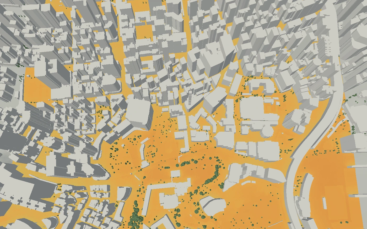
infrared.city can help a city connect that question to specific locations. Its heat-stress simulation shows the share of a selected period that each ground cell exceeds a UTCI heat-stress threshold. UTCI combines air temperature, humidity, wind and radiant heat.
A planning team could compare existing conditions with proposed trees, shade structures or surface changes. The comparison would show where exposure falls and where it remains high. Keeping the weather, period and settings fixed makes the options comparable.
This supports citywide adaptation: rank districts, identify hotspots and test cooling options at those locations. For the measures discussed by NPR, the useful decision is not just how much canopy or reflective roofing to add. It is where each measure helps at pedestrian level.
The output describes heat-stress frequency, not a personal health outcome.
Connect investment to daily operations
Long-term projects and daily service planning need different views of the same city. Infrared Core provides street-level thermal comfort, wind and solar simulations for both.
The live climate layer adds forecast-driven results that teams can query by place and hour. A municipal operations team could use those maps to review exposed collection routes or event locations during a heat wave.
That gives the NPR story a concrete planning test: does a proposed cooling measure reduce exposure at the places and times that matter for city services?
Sources
- NPR , accessed 3 Nov 2026.