Fast and flexible
Seconds per site, so you test many options and change them freely. About 3 s for a city block, results while you design. An entire city, too. (footnote 1)
 Platform Book a call
infrared.city next to SOLWEIG, ENVI-met, PALM-4U and Orbital Stack.
Fast and flexible
Seconds per site, so you test many options and change them freely. About 3 s for a city block, results while you design. An entire city, too. (footnote 1)
12 models
Outdoor wind and heat, sun and sky, facades and roofs, interior daylight and energy. One engine. Simulation library
Cloud native + API
A browser app, a hosted API and SDK, plugins for Grasshopper, QGIS and ArcGIS. Nothing to install or operate.
Enterprise scale
Big jobs run across many servers in parallel: 400 km² in 44 s. (footnote 6)
Real 3D geometry
Actual building and terrain meshes. Sun on every facade and roof of a 500 m block, 581,334 surfaces, in about 6 s. (footnote 1)
Site to city
The same method at every scale, so you can screen a whole building stock or many variants.
Live climate layer
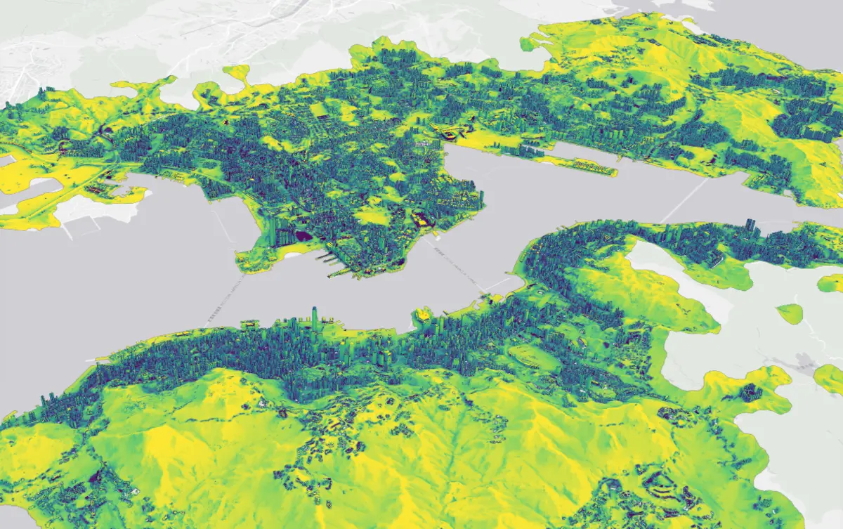
A whole city, again every hour, with a 72 h heat-stress forecast at metre scale. Scenarios use the same engine: same method, same numbers.
We compare the software stacks: speed, scale, analyses, geometry and how you run them.
Swipe to compare →
| infrared.city (footnote 1) | SOLWEIG (footnote 9) | ENVI-met (footnote 8) | PALM-4U (footnote 7) | Orbital Stack (footnote 12) | |
|---|---|---|---|---|---|
| SpeedA typical UTCI calculation, per km² and simulated day. Rough estimate, footnote 14. | ~5 sUTCI, 1 km², 08 to 18 h, geometry uploaded (measured). About 0.1 s per km² at 400 km². | ~7 s on GPUUTCI, 2 m grid. About 33 s on CPU. | ~45 daysPer km² at 1 m, extrapolated from a measured 65 h for a 0.06 km² block (v5.9). A full microclimate run; UTCI is computed after. | ~4–5 daysPer wind direction and km² at 1 m, extrapolated from a measured 39 h for 8 directions × 6 h on 0.18 km² with 300 cores. A wind run, not UTCI. | Minutes (AI)A site is about 0.3 km² (300 m radius), so 3 to 4 runs per km². The CFD level takes 2 to 3 business days per site. |
| Smallest unit | A roomInterior daylight factor and energy need, room by room. | A street blockOutdoor radiation and comfort on a height raster. | A street blockOutdoor microclimate. No room-level daylight or energy. | A street blockOutdoor flow; the indoor model works per building, not per room. | One buildingThe study building with a 300 m context. |
| Largest single run | City scale400 km² of Berlin in 44 s. | ~39 km²On one GPU. | One site | CityOn a large compute cluster. | One site300 m context radius. |
| Analyses | 12 models | Radiant heat | Microclimate | Airflow, energy | Wind, comfort, solar |
| Geometry | Real 3D meshes | 2.5D raster | 3D voxels | 3D voxels | STL upload |
| Runs as | Cloud + API | DesktopQGIS plugin or Python package. | Windows desktop | Compute cluster | Browser appDetailed CFD only through RWDI consulting. |
| Agent-readyCan a script or an AI agent run it, with no person at the screen? | API, SDK, skillREST API, Python and TypeScript SDK, and an agent skill for Claude Code, Cursor and Codex. MCP server coming. | Python scriptsRuns headless as a Python package; no hosted API. | No public APINone found on the vendor pages, checked 30 Oct 2026. | HPC batch jobsScripted runs on a compute cluster; no hosted API. | No public APINone found on the vendor pages, checked 30 Oct 2026. |
| Licence | TokensFree plan to start. | GPL-3.0 | SubscriptionNo public prices. | GPL v3 | Pay per run |
| Live climate layerAn hourly climate layer for a digital twin. | HourlyFor a whole city. | Not offered | Not practicalHours per run. | Not practicalHours per run. | Not offered |
Not in the table: EnergyPlus, a different job (footnote 4), and SimScale, a general cloud CFD platform (footnote 13).
infrared.city uses the actual building and terrain meshes. It does not turn the city into a grid of cells. Arcades stay open and sloped roofs stay sloped. (footnote 1)
Illustration: the same building in three ways of storing shape. Cell size is exaggerated to show the effect. Sources: infrared.city internal validation report (Oct 2026, available on request), and the tools' documentation.
Run time per km², one day
Typical UTCI calculation, rough estimate per km² and simulated day; physics differ. Linear: 24 h wide. Log: 1 s to 100 days.
Zoom: the first minute
Measured Extrapolated
Orbital Stack: minutes per site with AI, 2 to 3 business days per site with CFD; a site is about 0.3 km², and no per-km² time is published, so it is not drawn.12
Decide, operate, monitor
Every option, every street, every hour. Informed decisions from the first sketch, whole sites to whole cities in seconds, and a live layer to operate and monitor.
Validation of extreme or critical cases
For a final check of one chosen design or a critical case: full physics in hours to days per site.
Most teams use infrared.city to decide, and validate only the cases that need it.
infrared.city compared with ENVI-met, SOLWEIG, PALM-4U and Orbital Stack.
infrared.city and ENVI-met do different jobs. infrared.city tests every option for a block, a district or a whole city in seconds, on real 3D building and terrain meshes, in the cloud and through an API. ENVI-met is a Windows desktop tool for a full microclimate run on a 3D cell grid (voxels).
ENVI-met run time is published: 65 hours per simulated day for a 0.06 km² block at 1 m (version 5.9). We ran no same-input test against ENVI-met, so we make no accuracy claim against it. Most teams use infrared.city to decide, and validate only the cases that need it.
Yes, for radiant heat. SOLWEIG is a widely used research model for radiant heat. It works on a 2.5D height raster and runs on the desktop, in QGIS or in Python. infrared.city works on real 3D meshes and runs in the cloud with an API.
We tested both against field instruments on the same input: same points, weather and 3D scene. At Gothenburg the two are on par. Melbourne and Guelph are held-out sites. The chart and the method are on this page and on the validation page.
They serve different steps. PALM-4U is a detailed model on 3D voxels. It runs on a large compute cluster and gives airflow and energy results. In the speed row of this page, a wind run takes about 4 to 5 days per wind direction per km² at 1 m (extrapolated; a wind run, not UTCI).
infrared.city is for the decision step: every option, whole sites to whole cities in seconds, plus a live layer. Use a detailed tool such as PALM-4U for a final check of one chosen design or a critical case.
Both give wind comfort, thermal comfort and solar analyses. Orbital Stack is a browser app. It takes an STL upload and covers one study site with a 300 m context radius. Its CFD results arrive in 2 to 3 business days per site, and its AI results take minutes per site.
infrared.city uses real 3D meshes, runs 12 models from one engine, and works in the cloud, through an API and in the browser. Whole sites to whole cities take seconds.
infrared.city takes about 5 s for 1 km² when the scene is reused, and about 17 s for the first run (perceived heat, UTCI, 08 to 18 h, measured). The largest single run is 400 km² in 44 s, which is about 0.1 s per km². Larger areas get faster per km² because tiles run in parallel.
On the same rough basis, SOLWEIG takes about 7 s per km² on a GPU, ENVI-met about 45 days per km² at 1 m (extrapolated from one published run) and PALM-4U about 4 to 5 days per km² at 1 m (extrapolated). These are estimates. The footnotes on this page give the sources and the arithmetic.
We test radiant heat (Tmrt) against field instruments at four sites: Gothenburg, Phoenix, Melbourne and Guelph. Phoenix and Gothenburg are in-sample. Melbourne and Guelph are held-out sites: we changed no setting for them. We ran SOLWEIG on the same input as a reference.
The validation page lists all sites, the reference data and the method.
Use infrared.city to decide: it tests every option, from the first sketch, for a block, a district or a whole city, in seconds. Use detailed CFD and LES tools for a final check of one chosen design or a critical case: full physics in hours to days per site.
Simulation and design tools: ENVI-met, SOLWEIG, PALM-4U, Orbital Stack, Autodesk Forma, SimScale, Ladybug Tools, ClimateStudio. Urban heat data: FortyGuard, Satellite Vu, constellr, Hydrosat. Climate risk: Jupiter Intelligence, XDI. Digital twin and climate platforms: VU.CITY, Bentley iTwin, ArcGIS Urban, NVIDIA Earth-2, Destination Earth. Building LCA and ESG: LCA and ESG tools.