Your whole site. Ground, facades, roofs. In seconds.
Now in TypeScript, too — the same engine, from a Python notebook to a browser app.
- 8.9 s
- 3 facade analyses on real terrain
- 32 Mio
- facade sensors in one 33 s call
- 1,843
- buildings in one request
- 0.9 s
- one analysis on a design site
How a run works
You draw one polygon. The SDK cuts it into tiles, packs every building into batches, runs them in parallel and stitches one seamless result. 45 seconds.
Real cities, not boxes
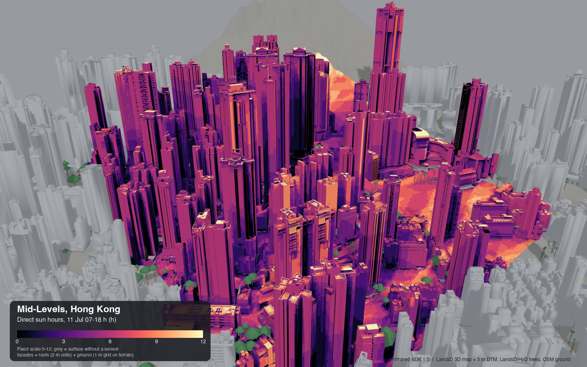
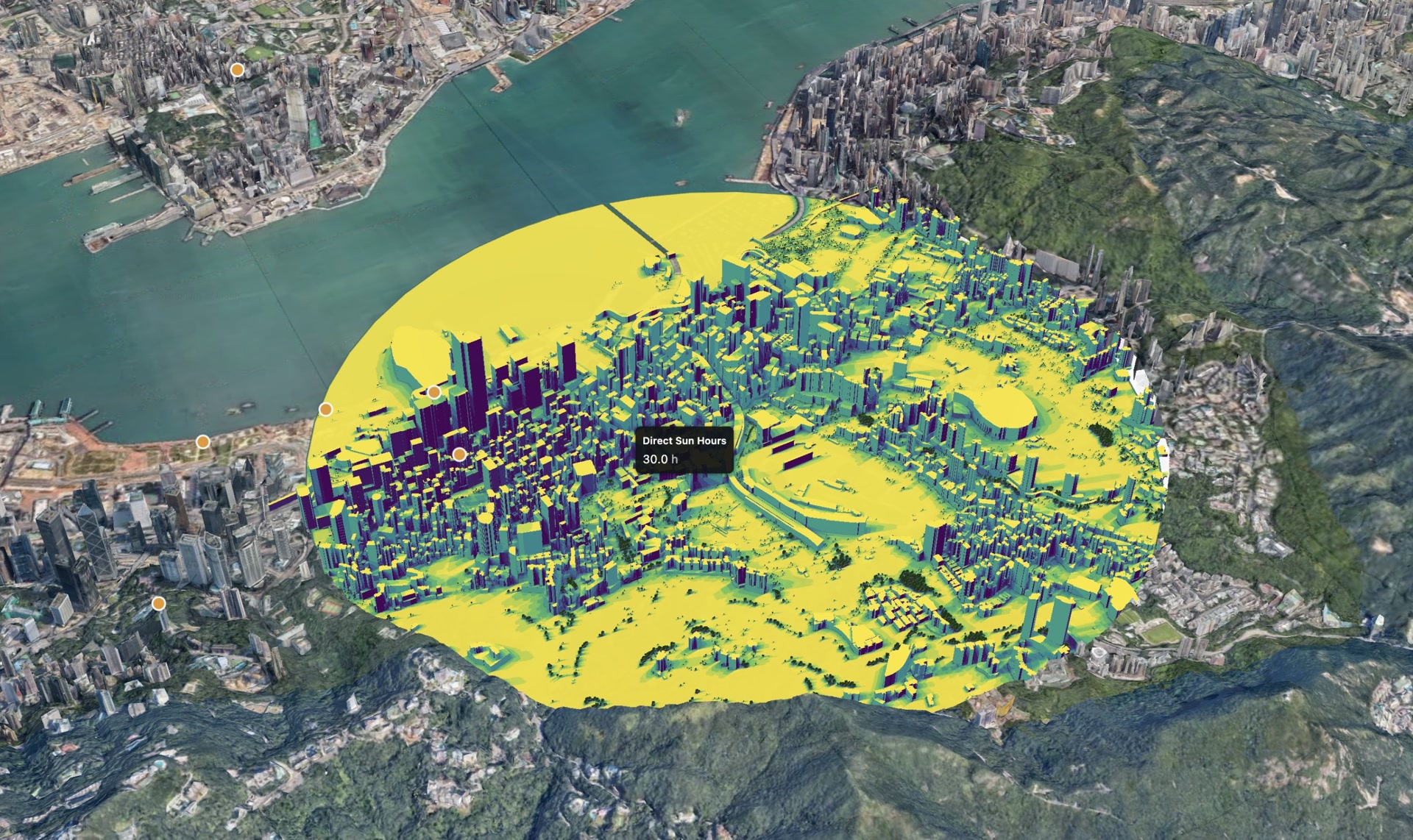
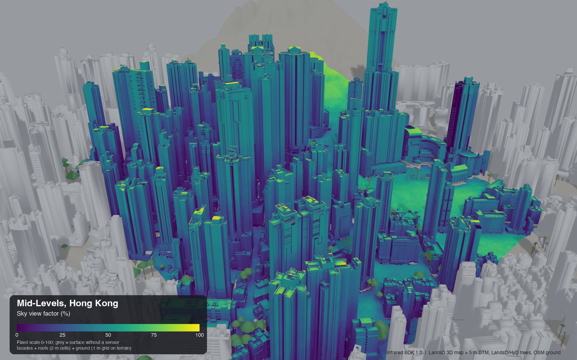
Draw any shape on a real city, or bring your own buildings, terrain, trees and ground materials. This run covers Central and Wan Chai in Hong Kong, from the harbour up the slope of the Peak. Every tower casts its real shadow on the streets, the facades and the roofs.
- Any polygon, not only rectangles
- Terrain as a drape, buildings at their true heights
- Trees, asphalt, grass and water change the result
Where the heat hits people
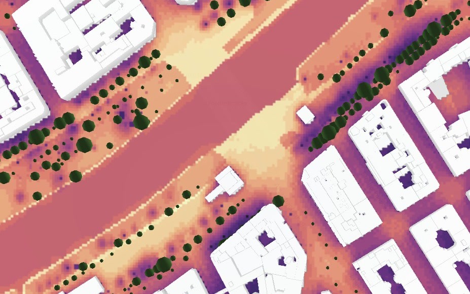
UTCI is the temperature your body feels: sun, shade, wind and humidity together. Along this canal on a hot afternoon, the open quays and the bridge heat up most. Tree rows and inner courtyards stay cooler. The map shows which streets need shade first.
- Every tree and its shade in the result
- 1 m grid with hourly weather
- Run with and without new trees, compare the difference
Every facade, every roof
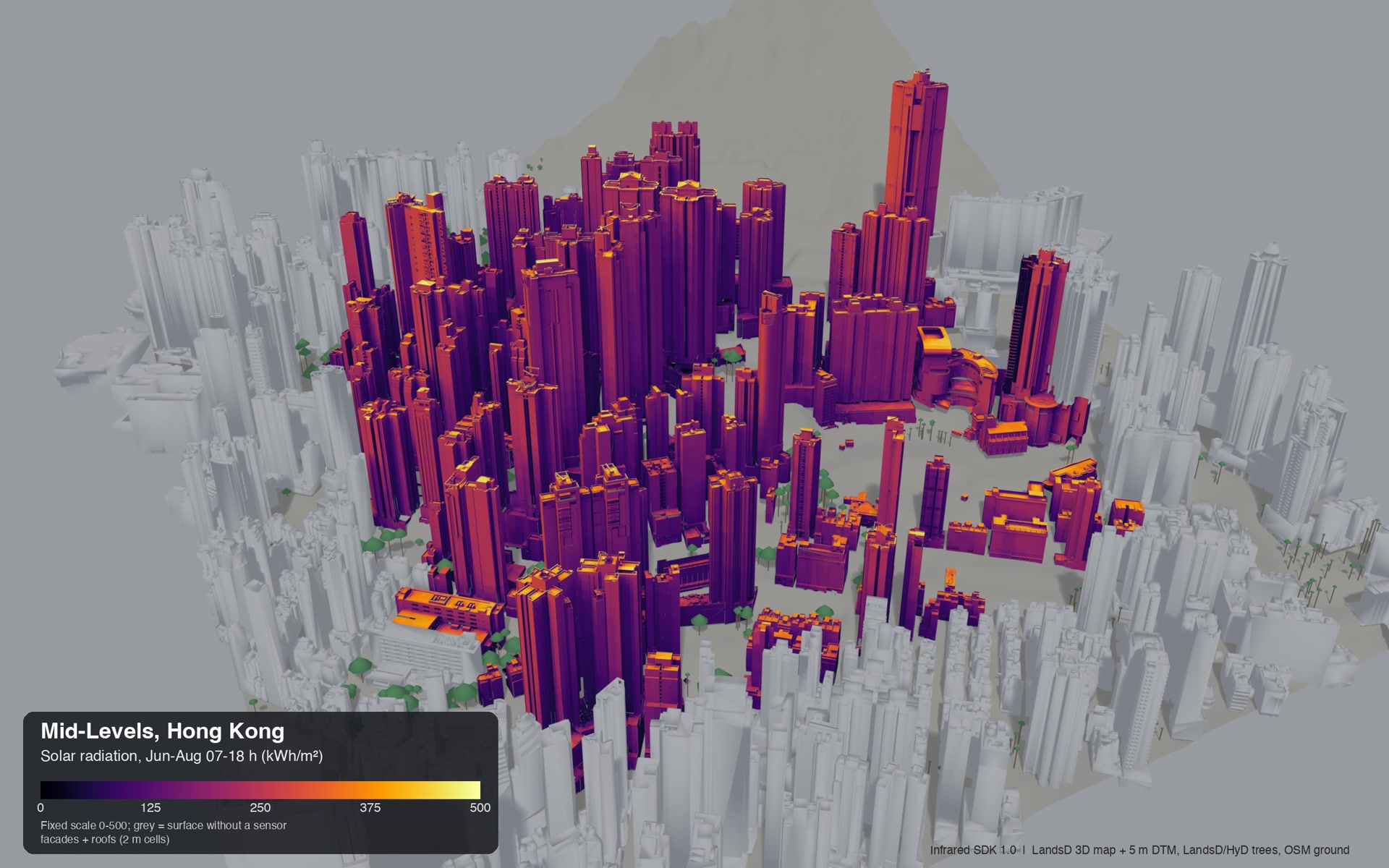
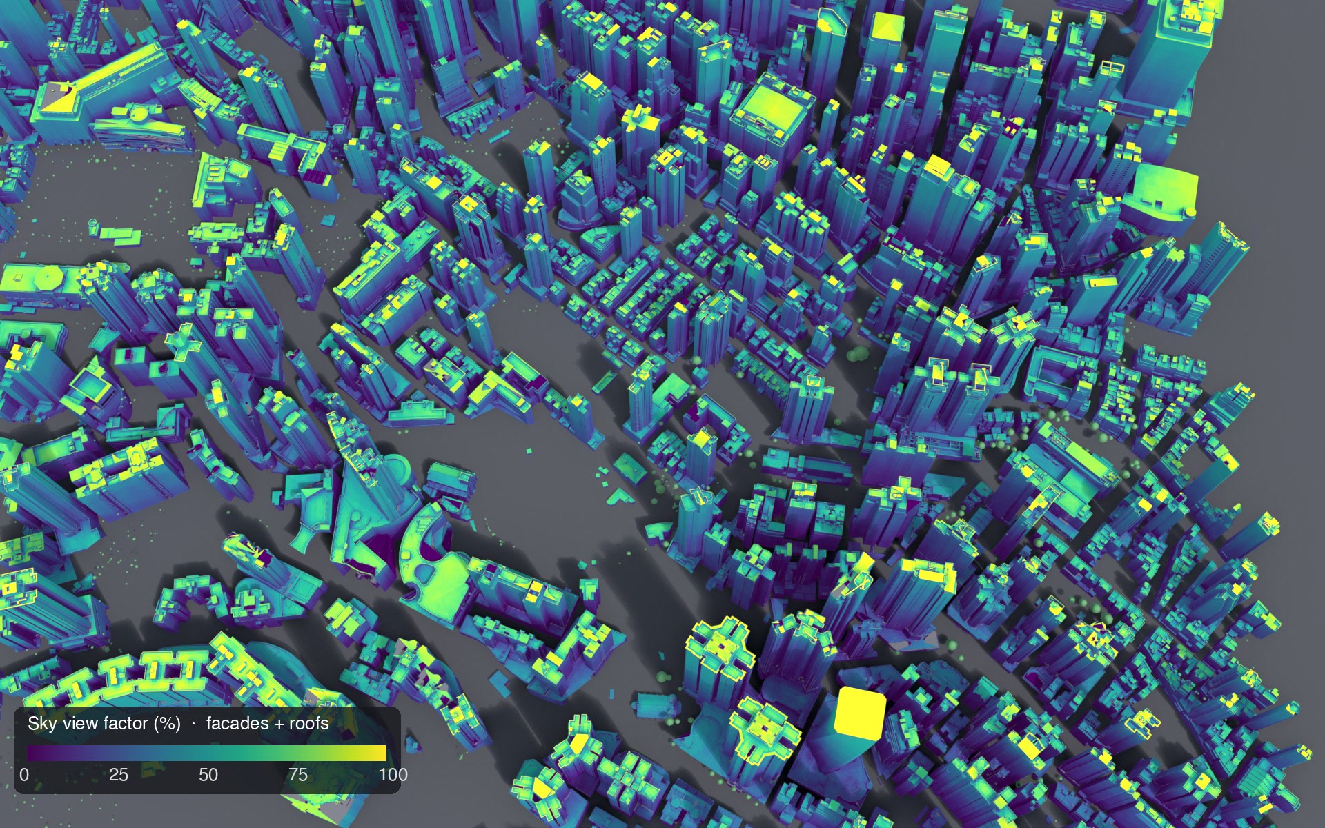
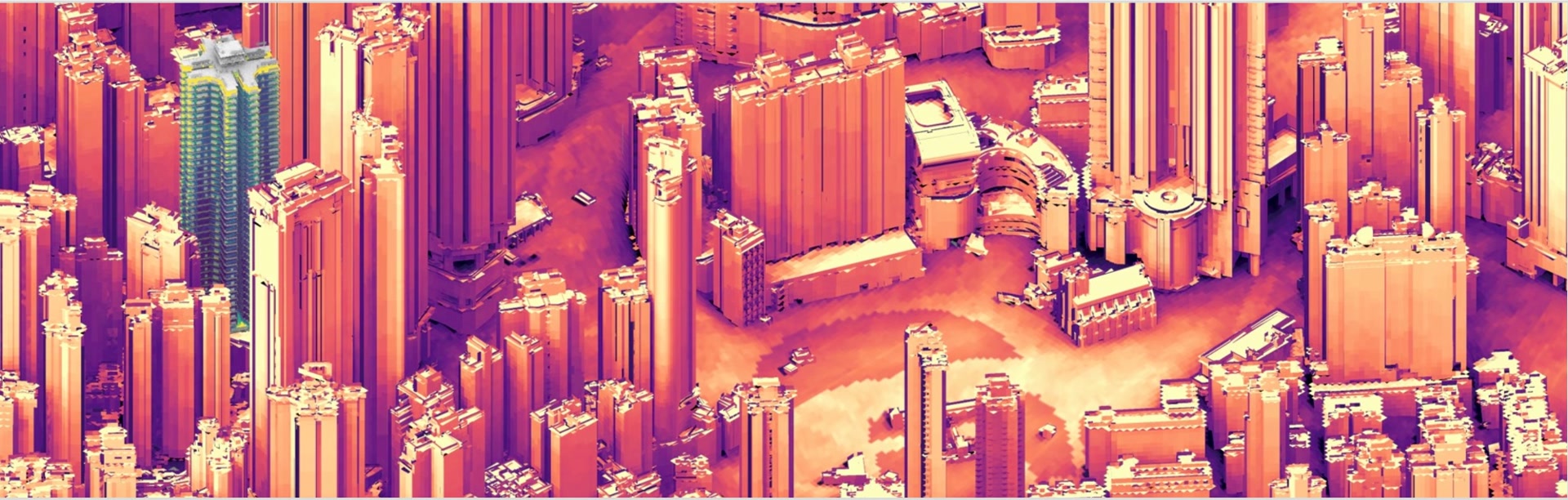
Set analysis_surfaces="all" and every wall and roof gets its own sensor grid. Run sky view factor, sun hours and solar radiation in one call: 660,037 sensors each, 8.9 seconds.
- 2 m cells on every surface
- Several analyses share one upload
- Render buffers ready for three.js, deck.gl or Blender
A whole district in one call
1,843 buildings, 1.2 by 1.2 km, 2.5 Mio facade sensors. The SDK plans the jobs, uploads the geometry once and merges one result. Run it again and nothing uploads twice.
- Four analyses on 10 Mio sensors in 16 s
- No hand tiling, no merge code
- Free cost preview before every run
Questions you can answer
Which streets do we shade first?
UTCI and surface heat across the district at the hours that matter, so the shade budget lands where people feel it.
Where is the best facade or roof for PV?
Solar radiation per cell ranks every roof and facade by yield potential, before you commit panels.
Which corners fail wind comfort before sign-off?
Pedestrian wind comfort against the Lawson criteria, across a full year of weather, flags the spots to fix early.
Will these trees actually cool the street?
Run the street with and without the planting. The difference between the two runs is the answer, in degrees.
Which massing option holds up in a heatwave?
Compare variants through the same engine. Differences between options are more reliable than any single absolute value.
Do these flats get daylight, or do we re-plan?
Daylight on facades and daylight factor inside rooms (beta) catch the dark units while the layout can still change.
Coming from the legacy API?
| Feature | SDK 1.0 | Legacy run-analysis API |
|---|---|---|
| Running | ||
| Site size per request | Any polygon, tiled for you | One 512 x 512 m box |
| Analyses per call | Several, sharing one upload | One |
| Typical site | Seconds | About 3 minutes, tiled by hand |
| Cost preview | — | |
| Inputs and results | ||
| Facades and roofs | — | |
| Terrain, trees, ground materials | — | |
| Detailed meshes | Send your real model | Simplify massings |
| Python and TypeScript | — | |
Your coding agent already knows it
Install the Infrared City skill and Claude Code, Cursor, Codex or Copilot write correct SDK code from a plain request: the right calls, the coordinate frames and the traps that otherwise cost a day.
/plugin marketplace add Infrared-city/infrared-skills
/plugin install infrared@infrared-skills
- Ask: run sun hours on the facades of my Rhino model
- Cookbook: notebooks, a FastAPI service, map and 3D apps
- The whole guide as one file for agents
See it running
Live climate layer
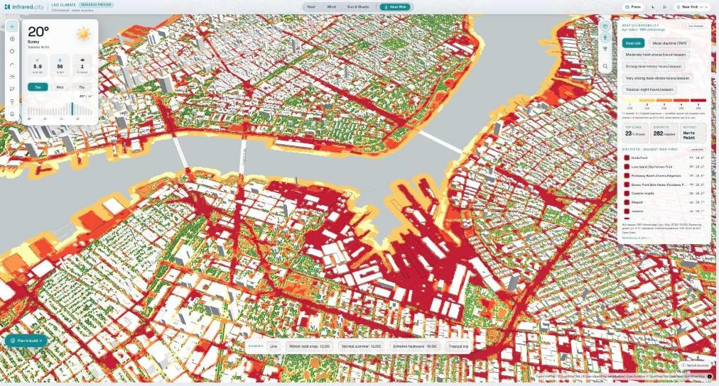
Street-level heat in live cities, with shaded routing and heat alerts.
Platform
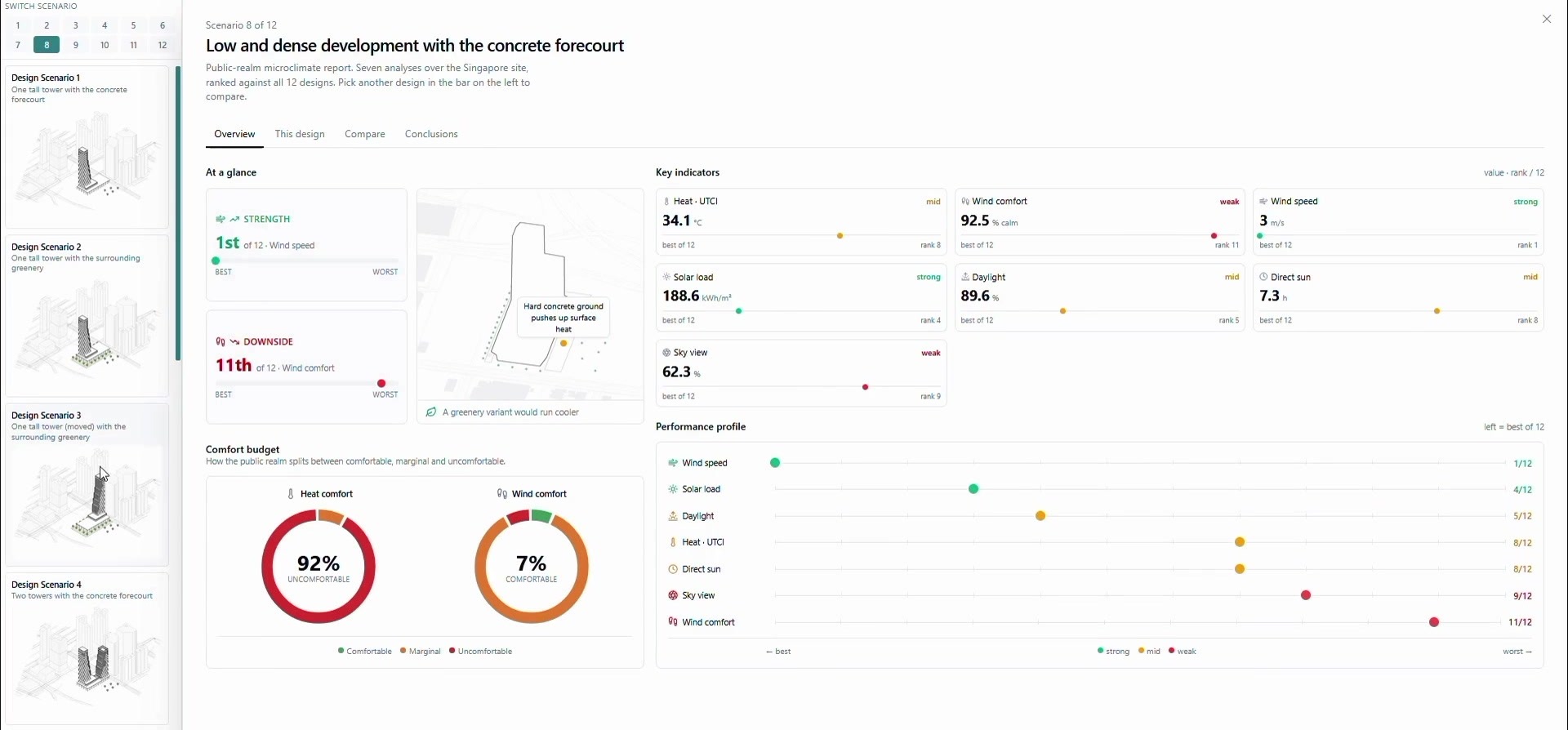
Upload your own buildings and weather, run analyses and compare design variants without code.
Starter apps
Wind, sun hours, heat map and facade examples on the TypeScript SDK, ready to fork.
Questions developers ask
How fast is it really?
Measured with the Python SDK on a laptop: one analysis on a small design site in about 1 second, three facade analyses with real terrain in 8.9 seconds, four analyses on 10 Mio facade sensors in 16 seconds. A repeat run on the same client is faster, because the geometry is not uploaded again.
How accurate are the results?
Results are screening-grade: they compare design options reliably and show where to look early in design. They are not a certified measurement. Per-model validation studies are underway.
What does a run cost?
One job is one tile for one analysis. preview_area is free and local: it shows the jobs and sensors before you run anything.
Can I use my own model?
Yes. Send meshes from Rhino, Revit, IFC, Blender or GeoJSON footprints, in metres from the south-west corner of your site polygon. Public buildings, trees and ground materials are a fallback when you have no model.
Python or TypeScript?
Both, with the same engine: pip install infrared-sdk and npm install @infrared-city/infrared-sdk. The TypeScript SDK also runs in a browser Web Worker.