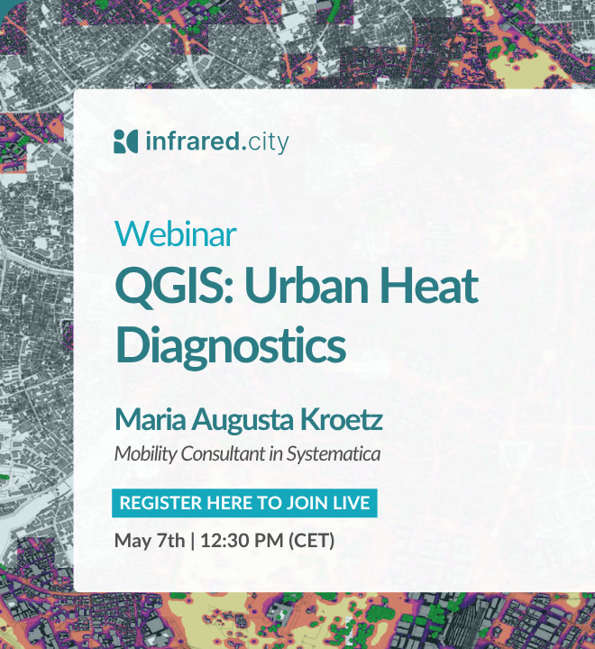
QGIS: Urban Heat Diagnostics
Powering Your GIS Workflow with Real-Time Environmental Simulations
- 1.3k+
- Projects optimized
- 5 min
- To full climate report
- <1 min
- Per simulation
- +10%
- Performance gains
Guest Speaker
We are joined by Maria Augusta Kroetz, Urban and Mobility Planner at Systematica. With a background in architecture and urban planning across Brazil, Italy, and Spain, and a master's in City and Technology from IAAC Barcelona, Maria Augusta works at the intersection of spatial data, urban analysis, and planning practice.
She brings a practitioner's perspective to how GIS tools can be put to work on real urban challenges — and will present how she integrated infrared.city simulations into a real urban project during the webinar.
- Urban and Mobility Planner at Systematica
- MSc City and Technology — IAAC Barcelona
- Architecture & urban planning across Brazil, Italy and Spain
- Spatial data and climate analysis practitioner
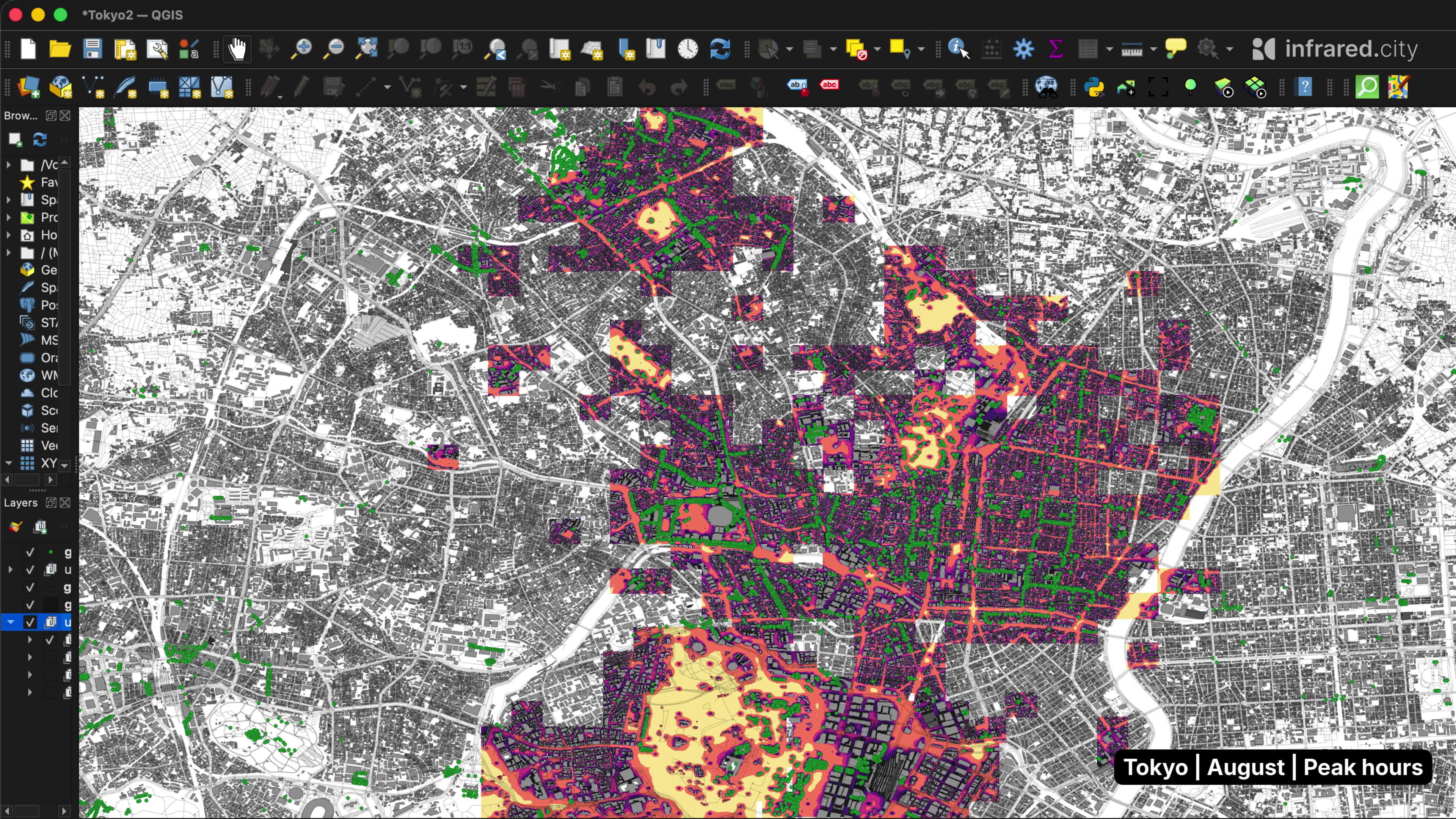
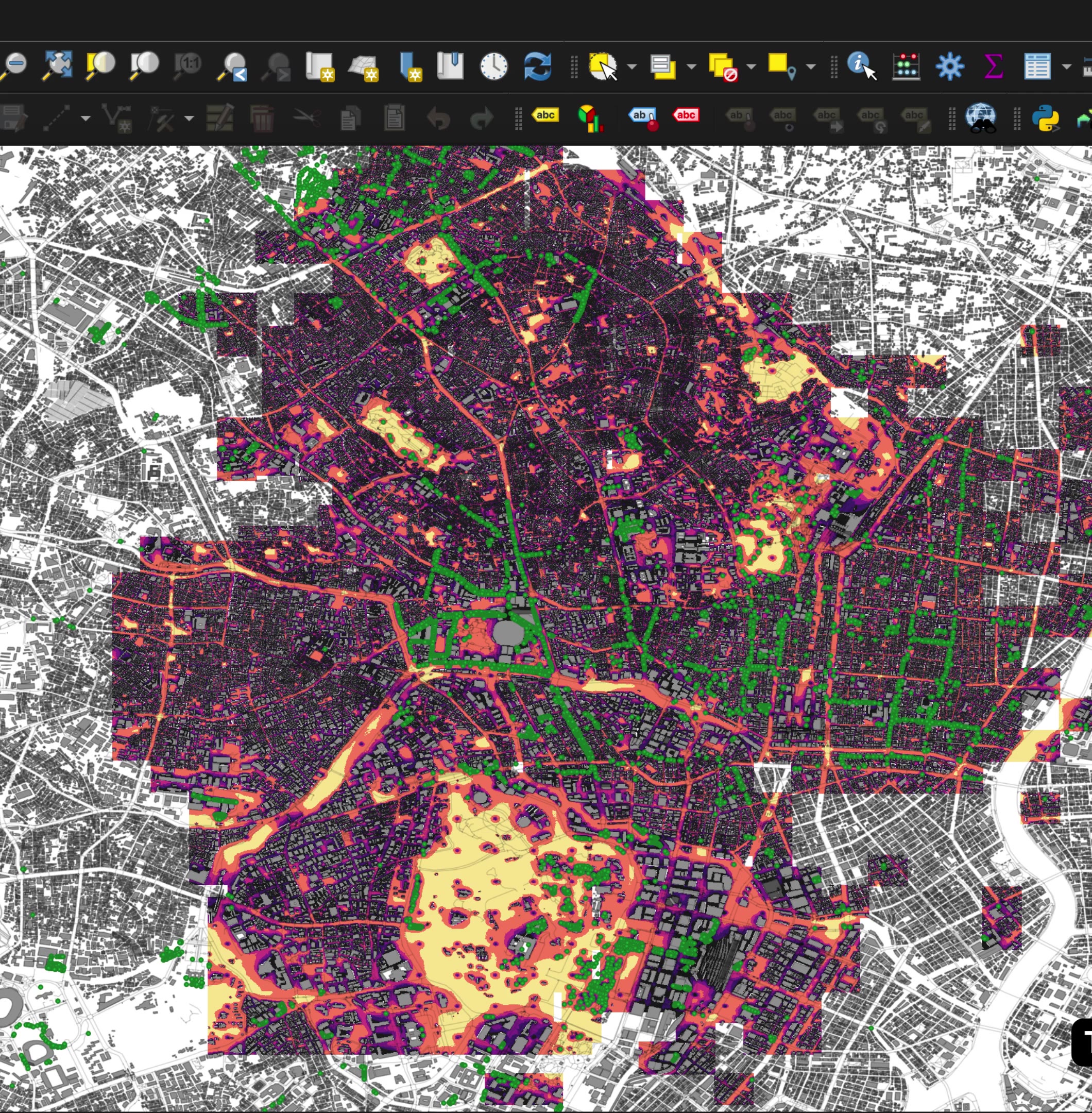
Native QGIS Plugin
Simulate wind comfort, solar radiation, and urban heat directly from your QGIS workspace. No file exports, no context switching — just results layered on top of your existing geodata.
- Wind speed
- Pedestrian wind comfort
- UTCI thermal comfort
- Heat stress & cold stress
- Solar radiation
- Daylight availability
- Sky view factor
- Direct sun hours
What You Will Learn
-
Heat as a Native Layer
How heat and thermal comfort data can be integrated directly inside a QGIS workflow
-
Real Project Case
Maria Augusta Kroetz presents how she applied infrared.city simulations in a real urban project
-
Planning Outcomes
What environmental data adds to spatial analysis and how it maps to planning decisions
-
Your GIS Practice
How to structure environmental simulation as a core part of your GIS workflow — no new tools to learn
Reserve Your Spot
7 May 2026 · 12:30–14:00 CET · Online — watch infrared.city's QGIS plugin live for the first time