Hi neoBIM — a custom rundown of where we are and what's coming next.
Climate integration layer.
Wind, sun, thermal comfort — and daylight, shipping shortly. One SDK, eight simulation engines. Drop into any design tool.
- 8
- Simulation engines
- <10s
- Per result
- Batch
- Any-size polygon
- Python
- TypeScript soon
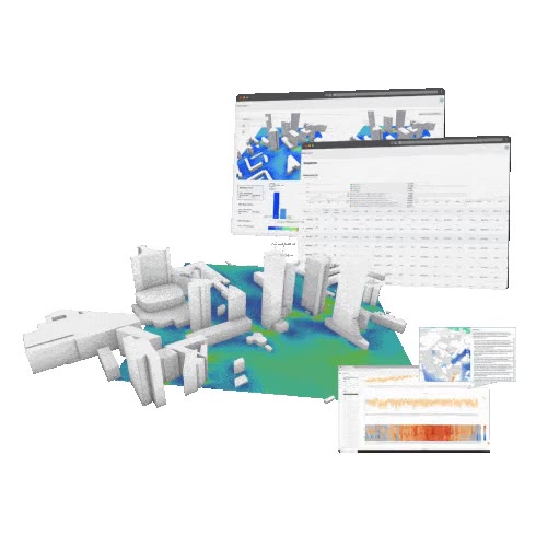
Built with the SDK. In two hours.
Try it — real simulation endpoints, all eight engines, automatic tiling for large areas.
What you get in pip install infrared-city.
Automatic tiling
Run on any city polygon. Tile splitting, parallel jobs, and result merging — one call.
Weather built-in
Nearest weather station lookup is part of the SDK. You bring your geometry, we bring the climate.
Eight analyses, one client
Wind, PWC, daylight, sun, solar, sky-view, UTCI, thermal stats. Async-orchestrated, all typed.
Build with your AI agents.
Drop-in skills for Claude Code, Cursor, and Codex, plus a Jupyter cookbook for every analysis. Your agents and your engineers share the same recipes — integrations that used to take a sprint now ship in an afternoon.
- Explanation of simulation types and results
- Agent-friendly SDK documentation
- Notebooks for every analysis

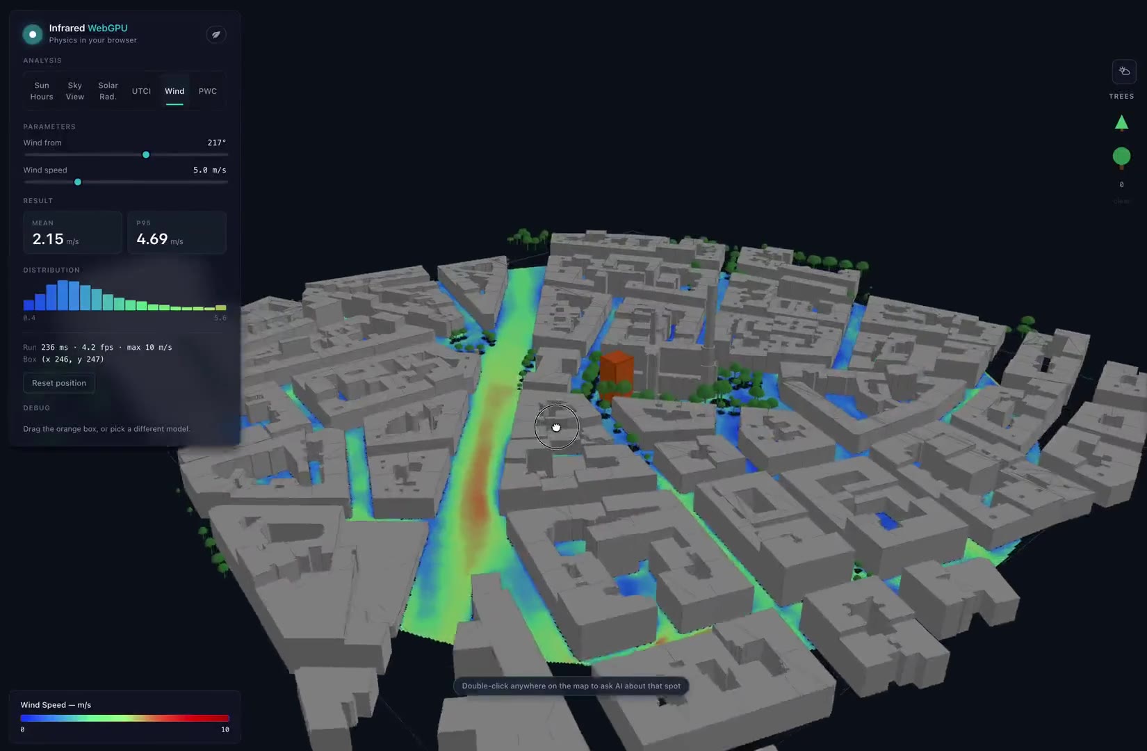
Realtime in the browser.
WebGPU port of the engines. Two paths, same wire format — a WebGPU client running fully in the browser, or a live socket session sharing a warm GPU container for heavier scenes.
- Wind ~7 fps · solar hours ~5 fps · UTCI ~1 fps (Vienna 800m, laptop GPU)
- Hot-swappable with the existing SDK — same wire format
- Zero per-query infra cost on the client path
Also in the pipeline
- TypeScript SDK — same surface, same wire format. Browser, Node 18+, Cloudflare Workers.
- Energy & embodied carbon — building on the indoor analysis layer.
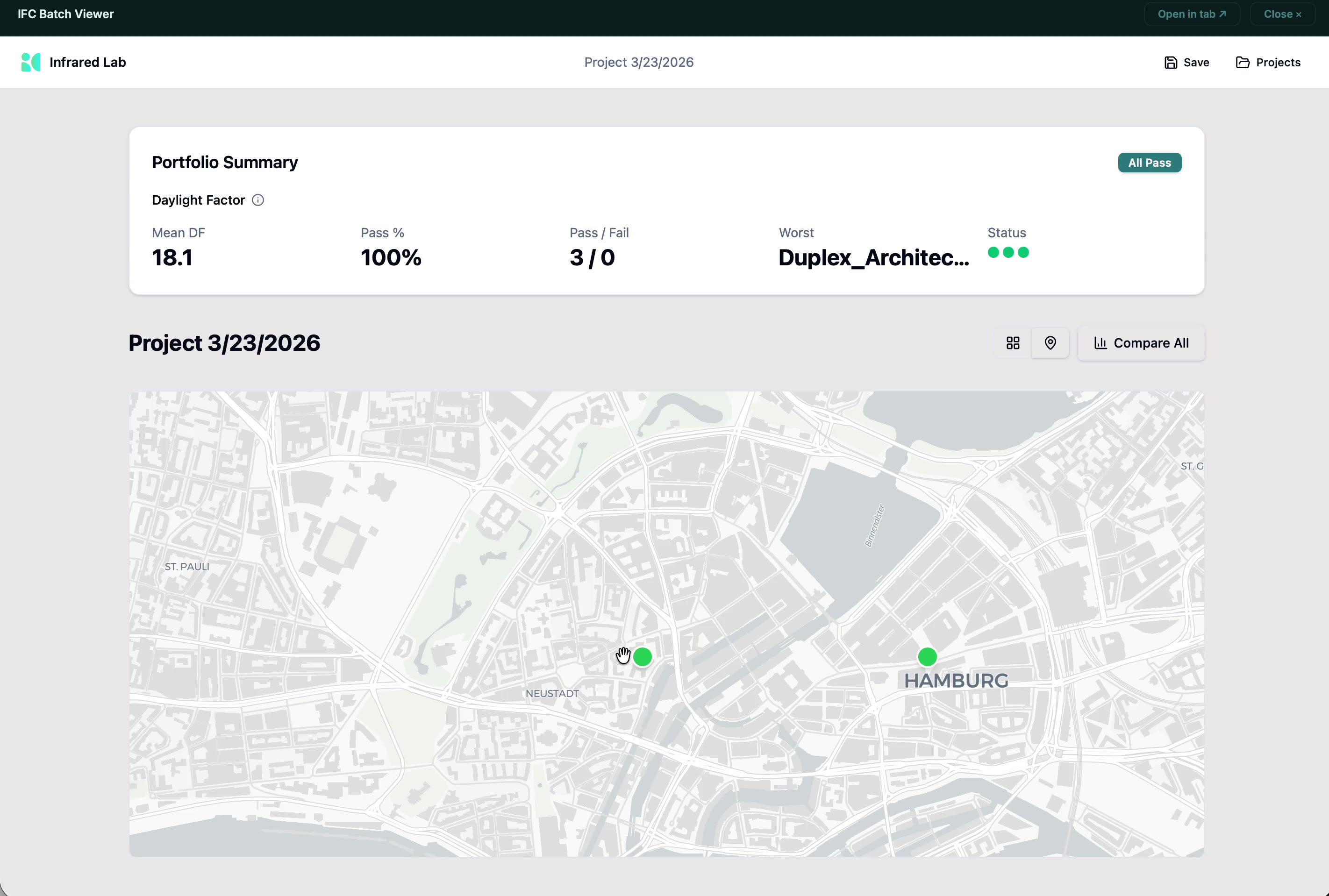
Indoor analysis — daylight.
Drop in your building model, get a 3D daylight heatmap on the inside. Energy and embodied carbon next on the roadmap.
- Per-floor daylight maps from your building model
- Schema-flexible — bring your own geometry format
- Same SDK — drops into the same workflow as the rest
Actionable insights, not raw simulations.
Expert-curated workflows take a design question and return a decision-ready answer. Skip the simulation setup, weather lookup, and statistical synthesis — climate experts have wired the whole pipeline together. You run one workflow and get composite maps, hotspot detection, and written recommendations you can act on.
- Actionable insights — composite maps, hotspot zones, written recommendations
- Climate experts curate the workflow end-to-end — not a black box
- Skip the simulation setup; just run the workflow
- Customisable per client and per topic
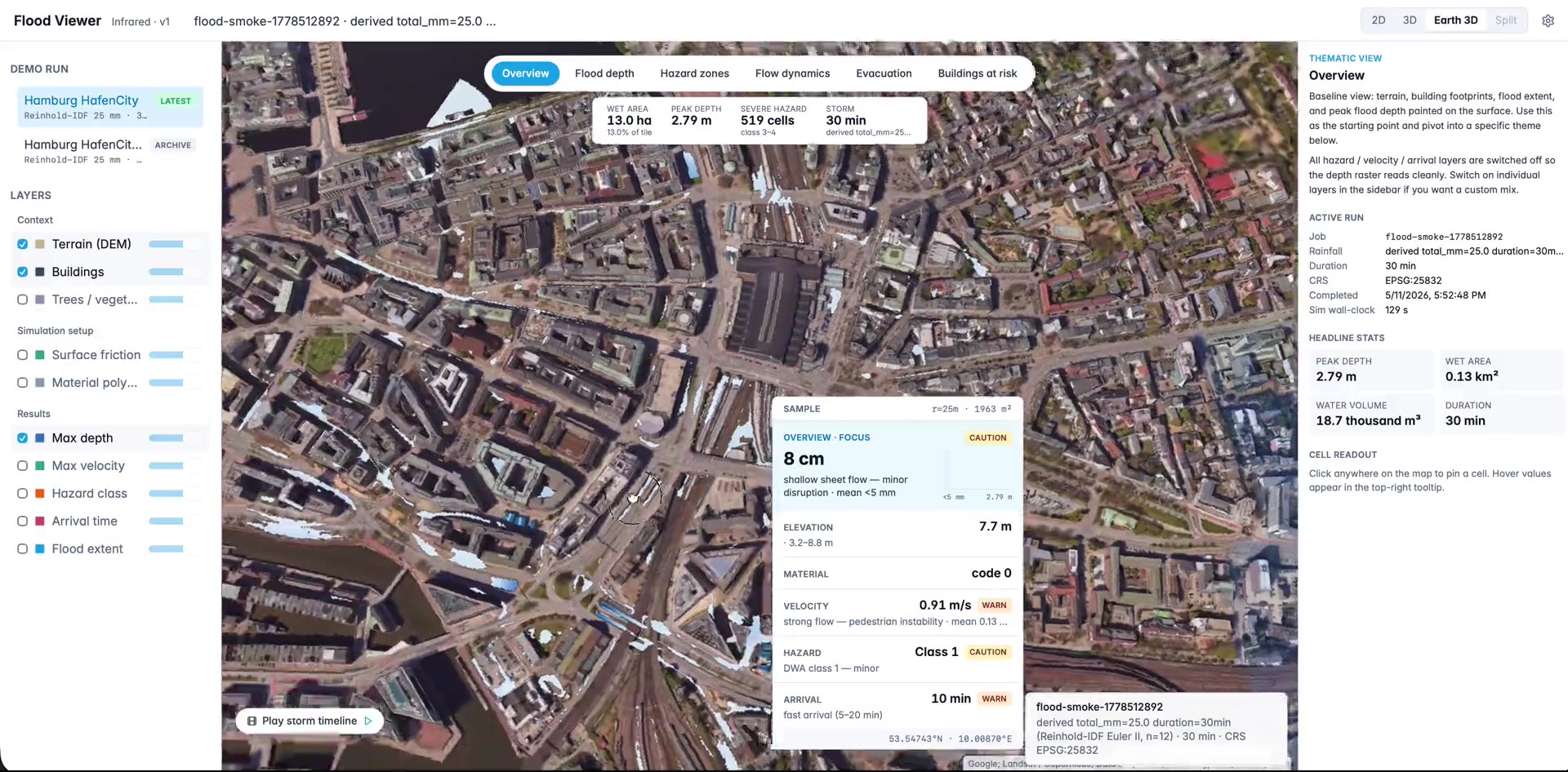
Pluvial flood risk.
Fast surface-water flood analysis for any site. Street-level risk maps in minutes, not weeks.
- Decision-ready outputs — depth maps, flow paths, building exposure
- Aligned with German KAnG climate-adaptation reporting
- Same SDK — drops into the same workflow as the rest